

Licensed Drone Professionals
PRECISION FROM THE SKY. RESULTS ON THE GROUND.
From thermal deer recovery to land mapping and herd analysis, Bad Axe Drones delivers fast, accurate insights across Central Wisconsin when it matters most.
Certified
Licensed and Insured
100%
FAA Compliant
24/7
Available During Season
THERMAL DRONE DEER RECOVERY
Shot a deer and can't find it? Don't risk bumping it off the property by walking in the dark. We fly thermal drones over your search area to locate your animal from above, no blood trail needed. When we find your deer, we drop a precise GPS waypoint and hand the coordinates straight to you.
SEE THE TECHNOLOGY IN ACTION
Real recoveries. Real results. From thermal signature to GPS pin, see exactly how Bad Axe Drones locates your animal in the dark.


WHY CHOOSE
BAD AXE DRONES
We’re hunters, landowners, and drone operators. We understand the importance of ethical recovery, but also the value of knowing your land inside and out.
That’s why we’ve invested in professional-grade thermal imaging and mapping technology to help hunters, property owners, and businesses get clear, reliable answers when they need them most.
We know Wisconsin land & law
Wisconsin has stricter rules than most states. We follow FAA, DNR, and state regulations so every flight is legal, safe, and done right.
Advanced Thermal & Mapping Technology
We use professional-grade thermal drones and mapping software — not hobby gear. With reliable connectivity, we can operate efficiently even in remote areas.
Built for the Way You Use Your Land
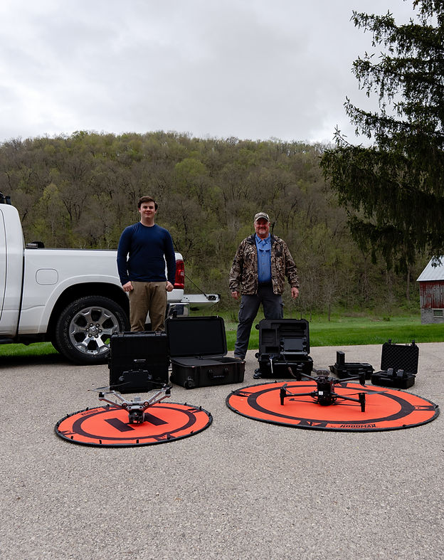
We’re a father-son team that understands hunting, land management, and rural properties. Whether it’s recovery, mapping, or analysis, we approach every job with the same care and respect.
WISCONSIN THERMAL DRONE SERVICES
Professional drone services for hunters, landowners, and businesses across Central Wisconsin.
WHAT OUR CLIENTS ARE SAYING

READY TO REACH OUT?
Whether you need recovery, mapping, or aerial insights, we’re here to help. Reach out and we’ll get you the information you need quickly.
Service Area
Serving up to 80 miles from Wisconsin Dells, WI.